Homer's Travels: Maps
Showing posts with label Maps. Show all posts

Tuesday, July 18, 2023

Camino 2023 - Similarities, Differences, Numbers, And The Future

This Camino was my third and, despite only completing a third of the way, I've learned a bit more about the Camino.  In the ten years since my second Camino some things have changed and some have remained the same.  

So how have things changed? The biggest change to the better is there is more support for the pilgrim.  There are now outfitters near the start in Saint Jean Pied de Port.  There are now food trucks spaced out along the way.  More bakeries and bars are opening up early for breakfast services.  On my first two Caminos if you didn't buy food the day before you walked, you had to wait until mid-morning before you could find an open store or bar.

I never really experienced a language barrier on my previous Caminos since I do know some spanish but I have to say that having a smartphone with Google Translate often made things a lot easier to navigate.  Pointing your phone camera at a menu and seeing what you are actually ordering was a nice change.  Strangely I never missed having a phone with me on my two Caminos.  I guess you can't miss what you've never had.

Speaking of smartphones, I carried a camera with me and I ended up never using it.  It was always easier to pull out my phone to take photos and the quality was as good if not better than my waterproof Nikon camera.  If we'd run into a lot more rain the camera might have been used more but the phone did a great job this Camino.  I also carried my tablet for editing photos which was also unnecessary.  I could have saved myself a few pounds leaving the camera, tablet, extra batteries, and chargers at home.

Not all the changes to the Camino experience were positive.  The crowds I'd seen on my second Camino (fueled by the movie "The Way") were still there and, in fact, were worse.  To avoid feeling like you were in a race you had to make reservations at the albergue at your destination.  You probably could walk the Camino without reservations but you would probably end up in the less desirable albergues or you had to hurry to beat the reserved crowds.  One thing that surprised me was municipal albergues were taking reservations too.  Ten years ago municipals were strictly a first come first served proposition. A good change here is that there were a lot more albergues along the Camino than there were ten years ago.

With the larger crowds there are more tourigrinos - tourist pilgrims that taxi their bags ahead and walk with just a day pack.  There has always been this type of pilgrim but they were traditionally either older, injured, or handicap people who couldn't carry a backpack for long distances.  On this latest Camino we saw a lot of able bodied people skipping the backpack carrying.  The Wife and I both were irritated with people, often ten to twenty years younger than us, carrying only a small day pack with water and snacks, complaining about how hard it was.  Strange how people who carried full packs everyday rarely complained.

There are a few options for doing the Camino other than walking.  Riding a horse or a bicycle are also 'acceptable' to get a Compostela certificate of completion.  In the last ten years electric bikes have made an appearance.  I find this a bit unfair ... especially to regular bike pilgrims who are doing a lot of work.  Every time a group of electric bikers rode by and yelled "Buen Camino!" the Wife and I would mutter FU under our breath.

While the crowds were big, the attitude of the pilgrims were much more positive than I experienced on my second Camino.  It felt like the pilgrims were there for the right reasons.  They knew what they were getting into and they understood that pilgrimage was not meant to be easy.  I think the negative attitudes I ran into last time were due to incorrect expectations created by seeing "The Way". 

Along with this more positive pilgrims came more of a Camino Family feel.  As the Wife and I met people we formed an intermittent family halfway between the more cohesive family I had on my first Camino and the more transient small groups I met on my second Camino.  I suspect if we had continued the Camino our family might have become more cohesive farther ahead.

-----

Now for a few numbers:

  • The Wife and I walked 184 miles (296 km) over fifteen days and averaged around 12.25 miles (19.7 km) per day.
  • We walked around 2 miles (3.2 km) per hour (this is the average including rest stops).
  • We climbed 19,800 feet (6,035 m) and descended 17,487 feet (5,330 m).
  • We stayed in thirteen albergues and two hotels between Orrison and Burgos.
  • We stopped in four towns where I'd never stopped before.
Our Camino from right to left.  Green pins are starts and red pins are ends.

-----

When we decided to stop in Burgos, I thought this would be the final chapter of my Camino story.  Since we've returned the Wife has suggested that we should go back and, over two or three years, finish walking her Camino.  I kind of like the idea of being a Camino section hiker.  I can't say we will eventually finish my third and the Wife's first Camino - no one, especially me, can predict the future - but another chapter is in the works.  How the story ends ... who knows? 

Photos can be found in my 2023 Camino de Santiago (The Wife's Camino) Google Photos album.

Tuesday, July 19, 2022

Appalachian Trail: Gorham, NH (Rattle River Hostel, US 2) To Grafton Notch (ME 26) … And Back

Last week I was back on the Appalachian Trail (AT).  I was hopeful.  I was excited to be back on the trail.  I was looking forward to seeing and experiencing all the AT and Maine had to offer.  Let's see what actually happened. 
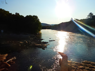
Crossing the Androscoggin River.
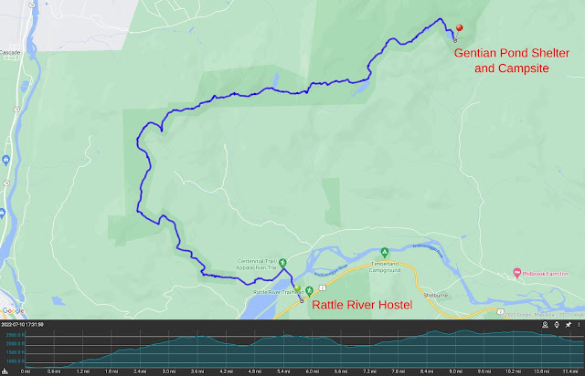
Day 1 - The shuttle dropped me off at the location of the now defunct Rattle River Hostel where I ended my AT attempt in 2019.  The first half mile was a road walk along North Road, across the Androscoggin River, and Hogan Road before I left the road and entered the wilderness.

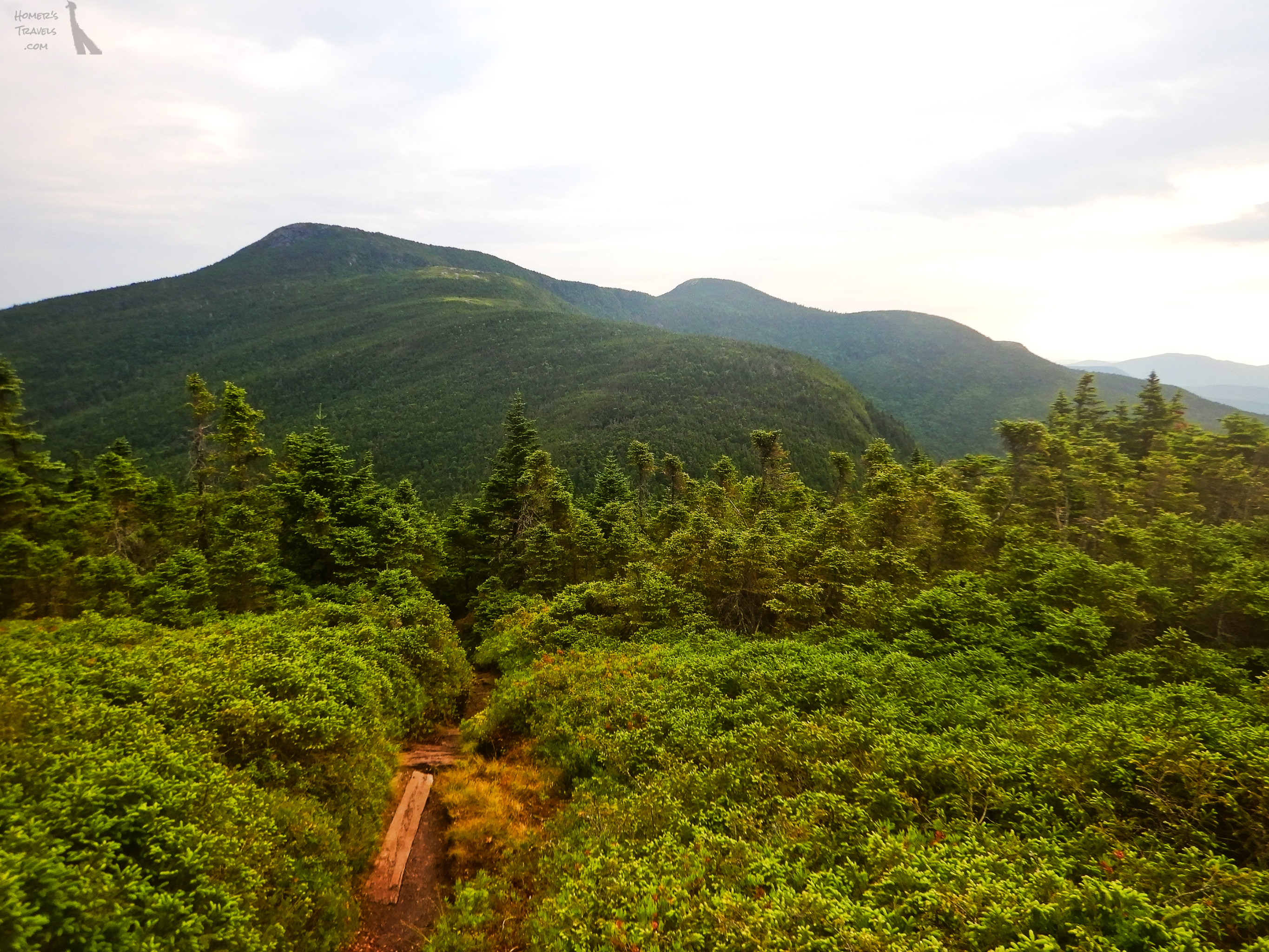
The trail started out similar to how I remembered it: a little rocky, a little rooty, not too difficult.  That changed quickly.  The rocks and roots became more numerous.  I was slowed down quite a bit but it was still within my AT hiking experience.  Near the top of Flat Mountain the views reminded me of what I enjoyed the most about AT.  The weather was perfect and the sky was blue and the mountains went on forever.  I was also starting to meet other hikers, both south bound (SOBO) and north bound (NOBO).

Not far from this first summit I passed by the 1,900 mile (3,057 km) mark.  If I'd continued back in 2019 this would have gotten me exited.  This time it didn't have the meaning it would have had.
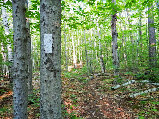
It started out so innocent looking.
As the trail continued it got harsher, rockier, rootier, and downright annoying.  Somewhere along the trail I took my first tumble and banged up my left knee.  It wasn't a show topper or anything but in the south it had taken a couple months before I took my first fall on the trail.  I found myself being more careful with foot placement which meant constantly staring at my feet.

Despite all the foot staring I still noticed the views at Page Pond and the summits I crossed on the trail.  This first day was a preview of what was coming ahead in Maine and I couldn't wait.

When I reached my goal for the day, Gentian Pond Shelter and Campsite, I was exhausted.  I know I had long, tired days in the south but this felt different.  This was beyond normal exhaustion.  I could hardly walk.  I was too tired to do anything.  I tried to make a meal but that didn't go well as I'd rather just lay on the floor of the shelter and moan.
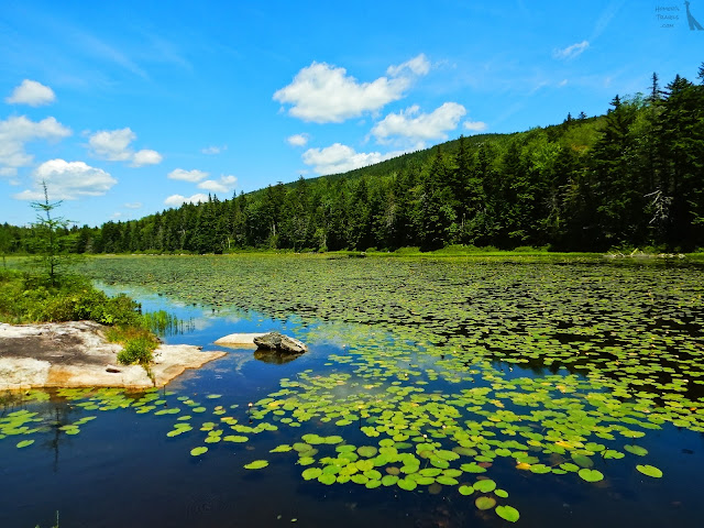
Page Pond.
This was not a good start.

My first day.  11.7 miles (18.8 km)

Day 2 -  Normally I was the first to get up.  The Sun was rising at 5:15am so I saw me getting up soon after.  That didn't happen. I stayed in my sleeping bag until other people got up at 5:40am  I ate breakfast, packed up my gear, and headed out to my next goal around 9.6 miles (15.4 km) away.  Between me and that goal were Mount Success, Mount Carlo, and several versions of Goose Eye Mountain (west, east, north).
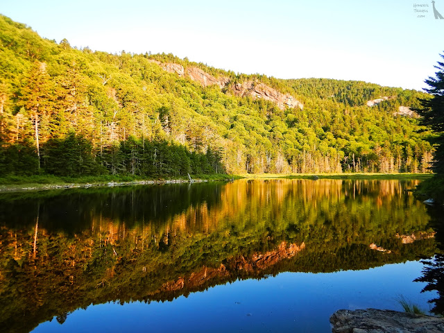
Gentian Pond in the morning sun.
It was during the climb up and over Mount Success that I realized I'd bitten off more than I could chew.  The trail was like an unending Stairmaster.  The unending rocks, varying from baby step ups to the stride of a giant troll, just beat up my legs.  It wasn't long before my legs were shaky (more about that in a future post).

Mountains as far as you can see.
I decided that, unless things got better or I felt better, I would quit when I got to Andover, ME.

My last state on the AT (#14)
I crossed into Maine, which was kinda cool, before I reached the turn off to the Carlo Col Shelter and Campsite.  I was exhausted … again … so I took the turn off and cursed the difficult 0.3 mile (0.5 km) side trail to the shelter.  I had three and a half swallows of water left when I got to the shelter.

With the decision to stop at Carlo Col Shelter, I missed my goal of the day by over 4 miles.  This was not a good sign and I decided to get off before Andover at Grafton Notch.  I figured I could get there in two 7 mile (11 km) days. 

That night I was joined by other hikers and a gaggle of fifteen plus pre-teen French speaking school girls (I presume they were from Quebec).
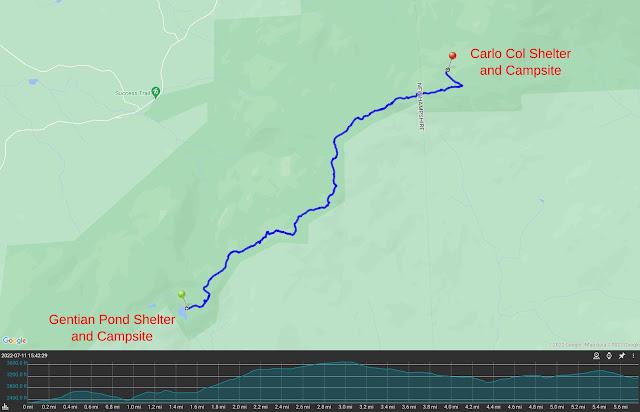
My second day.  5.2 miles (8.4 km)

Day 3 - Over the past few days SOBOs kept mentioning the Mahoosuc Notch and the Mahoosuc Arm.  I looked it up in my guide book and saw the description (Not sure how I had missed it during my planning).  It said: "Most difficult or fun mile of the the AT. Make way through jumbled pit of boulders."  *sigh*  My goal for the day had been a campsite between the Mahoosuc Notch descent and the Mahoosuc Arm climb roughly at the 7 mile point.  I changed my goal to make it easier.
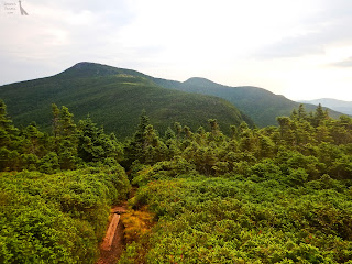
Mountains, trees, and bogs.
I left camp and headed north over the peaks I'd missed the day before - Mount Carlo and the several versions of Goose Eye Mountain. To my surprise it was hard (🌵).  This was a relatively dry part of the trail which meant I was carrying more water.  It didn't help too much as I was still conserving water before I reached the Full Goose Shelter and Campsite.  I said it was dry.  By that I'm referring to drinking water.  It did rain on me this morning … the only day when I had rain.

I looked at the miles ahead of me and decided, instead of the two sevens I'd planned, I would do three 5 mile (8 km) sections instead.  My restriction was food but … I wasn't doing a very good job of eating all my daily food so extending this section to five days instead of four wasn't a problem.
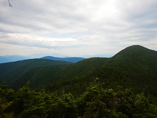
Did I hike over there … I think so.
I had my second fall on the way to the shelter.  Banged up my right knee.  Nothing major.  I always wanted a matching set of banged up knees.

I arrived at the shelter at 12:30pm and just slept and forced myself to eat all afternoon.  Forced because I had zero appetite … no hiker hunger.

A SOBO stopped here for the evening too.  He talked about how beautiful Maine was and how much he enjoyed it.  All I could think was how bad my body felt and wondered just how deep of an exhaustion a person could bear.
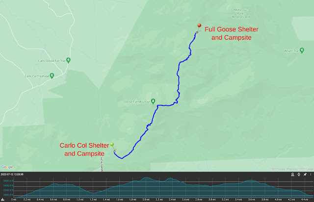
My third day. 4.4 miles (7.1 km)

Day 4 - I woke up in a mild panic.  I'd been dreaming of going through the Mahoosuc Notch and falling to my doom.  Not a good way to start your day.  I had two days to go to get off the trail and my subconscious and conscious minds were both concerned about getting off alive.
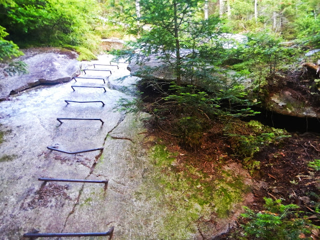
Surprised they actually gave us rebar steps.
I left camp and went up and over the Fulling Mountain south peak before I arrived at the start of the boulder jumble.

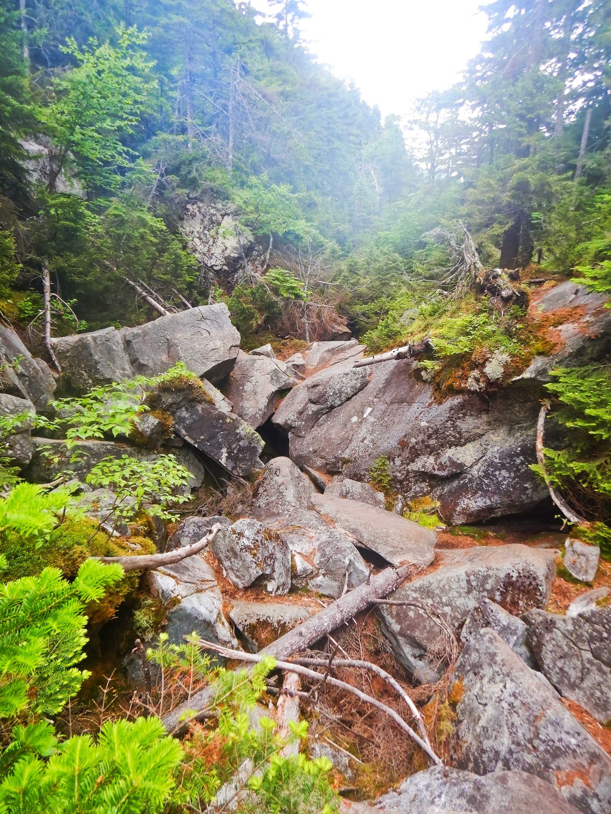
To get through this part of the AT it is best to put your poles in your pack since you will need free hands to climb.  I put my poles away and started rock hopping until I caught up with a NOBO from Georgia named Trouble.  We talked a little while we slowly made our way up, over, under, and around large boulders.  We both said it was nice to have someone to do this part with so there was someone to call 911 if the other got injured.
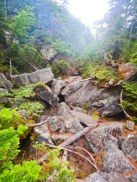
The start of the boulder jumble of Mahoosuc notch.
The hard part of the notch decent, besides having to climb up and down rocks with a pack on your back, was figuring out how to get through it.  There were white blazes (AT markers) on some of the rocks but the path to those blazes wasn't always obvious.  Several times Trouble and I just stood there looking trying to figure the best way through some rocks that wouldn't kill us.  Trouble was surprised we hadn't come across any skeletons and I said "that is probably the only trail maintenance they do around here" which made us both laugh.

There were three places where you were expected to go through a tunnel formed by boulders.  You had to take your pack off to squeeze through.  We decided to find alternative routes to skip most of these.

Despite the potential danger, the rock hop was pretty cool.  Between some of the larger boulders you could still see ice and snow.  When you walked by cave-like openings it felt like you were walking in front of an air conditioner.  We stopped at an accessible stream between the rocks and had our fill of water so cold it almost gave us brain freeze.  Was it difficult?  Yes, this wasn't hiking, it was rock climbing.  Was it fun too? I'd have to say yes.  One thing I am sure of … I would never try to do this in the rain.
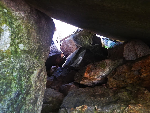
The arrow says go in but we climbed around.
We passed the campsite I'd considered going to the day before.  It was very nice but I'm glad I didn't push it. The trail then went straight up the mountain to a point known as the Mahoosuc Arm.  This trail was mostly long solid slabs of stone at a slight angle off vertical.  I think they expected you to trust the soles of your shoes to stick to that rock.  I used trees and roots along the side of the rocks to climb instead.

Trouble and I arrived at the Speck Pond Shelter and Campsite soon after.  Another hiker showed up and briefly disappeared.  When he reappeared his hair was wet.  Apparently he likes visiting ponds.  He likes to put on goggles and stick his head in the ponds he visits to see if there is anything interesting.  He then moved on ... I presume to another pond to stick his head in.

Having someone with me through this section helped a lot.  Trouble was continuing on to Grafton Notch.  I was too tired to continue on and spent the night in the shelter.  We thanked each other and said our goodbyes.  I think she will make it to Katahdin.
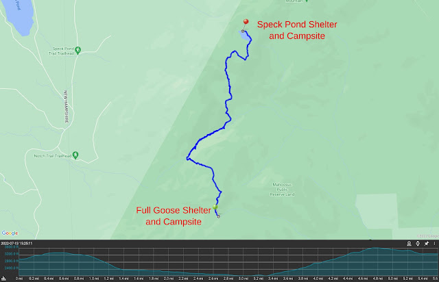
My fourth day. 5.1 miles (8.2 km)

Day 5 - So … this four day stage turned into a five day stage and covered 10 miles (16 km) less than I'd planned.  This didn't go as I expected.

Speck Pond.
I got up and had a slow morning around the shelter.  I went behind the shelter and walked down to the edge of Speck Pond.  It was a nice morning.  The water was like glass.  I noticed some ripples and saw a beaver apparently doing laps since it really didn't seem like it was going anywhere in particular.  I'd seen a small snake the day before at the same spot.

On top of Old Speck Mountain.
I left the shelter and climbed up Old Speck Mountain.  I sat at the peak and turned on my phone.  I called a shuttle to pick me up and made a hotel reservation.  I gave myself too much time to get down the mountain.
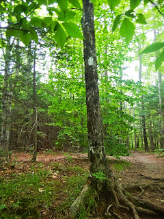
My last white blaze.
The descent was over 2,600 feet (792.5 m) but, compared to some of the other trails, it was relatively gentle.  I made it down to the road without incident.

My shuttle pick up time was at 2:00pm and I was there at 11:30am.  I sat with some SOBOs and told them about the Mahoosuc notch coming ahead for them.  It was more of a "It's not so bad" talk.  They were all young and I was feeling old.

My shuttle picked me up early just before the rain returned and I was dropped off in Gorham.

This … whatever this was … was over.
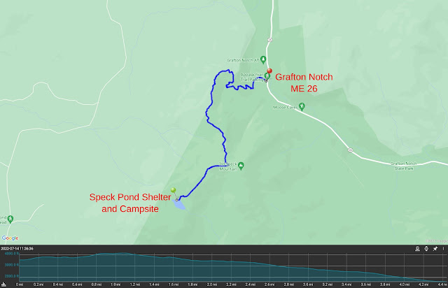
My last day on trail. 4.6 miles (7.4 km)
Pictures can be found in my 2022 Appalachian Trail Google Photos album. 

Total Distance*: 1,927.0 Miles (3,101.2 km)
Section Distance: 32.0 Miles (51.5 km)
Section Elevation Up: 11,632 ft (3,545 m)
Section Elevation Down: 10,778 ft (3,285 m)
* Total Distance includes the distance I hiked in 2019.

Monday, October 07, 2019

Appalachian Trail: The End Of An Adventure ... (?)

My 1,893.7 mile path.
I called my first Appalachian Trail (AT) attempt in 2017 a failure.  I was embarrassed, ashamed, and full of regret.  This time I am disappointed but I'm proud of what I did accomplish and have few regrets.

The AT was not what I expected.  My body gave out.  I expected that I would get stronger and have greater stamina the more I hiked.  This seems to be far from what happened.  It seems I peaked physically after the first couple of months then plateaued before declining after Pennsylvania.  Some of the decline was due to trail conditions (i. e. rocks) but I saw little improvement after the trail conditions improved. It was a bit demoralizing not to be able to do longer days like I could earlier on the AT.  The result was my plan, which assumed me getting stronger, was too aggressive.

Next I was also surprised by my interactions with other thru-hikers.  I was hoping for a more social experience with a group of new friendships that would last for years.  That is what I got out of my first Camino.   Why would the AT be any different?  It was different.  I met many people and formed fleeting friendships but they were always a bit superficial and never ended with any long term friendship.  Sometimes it was my fault for not trying harder to participate in social situations but when I'm exhausted I often become quiet and self-isolating. This often made my hike a lonely one especially after the midpoint when the number of thru-hikers thinned out.  This can drag on a person's mental state.

Lastly there was a lack of physical contact.  During the almost six months on the trail the only physical contact I had with another human being were fist bumps (the traditional thru-hiker greeting), the occasional hand shake, a massage I paid for in Waynesboro, VA, and a hug I got from George.  This can also drag on a person's mental state.

Not everything was bad.  The parts of America I saw along the way were beautiful and varied.  While parts of the trail are the proverbial green tunnel, where there were views they almost always made me pause to take it all in.

The people I met, even if for a ephemeral moment, were always wonderful.  You rediscover that there are incredibly nice people out there looking after you.  Your faith in humanity is bolstered with every encounter.

So, why did I quit when I was so close?  It was the unexpected aspects of the AT that forced me to quit.  Me not getting stronger meant I had to add more days to my plan which pushed my arrival at Katahdin to after the mountain would close for the winter.  This was exacerbated by the shortening of the days reducing the time I had to hike.  The lack of social interaction started to push me towards depression (they say hiking helps depression ... not necessarily for me, I guess).  Spiritually ... well at times my spirit was curled in a ball rocking back and forth in the corner.  All these things were often balanced out by meeting milestones that boosted my spirit but they all reached a critical mass near the end that overcame any high I got from reaching another milestone.

Now that I'm home, I have decision to make.  Do I return and do the last three hundred miles?  Obviously the thru-hiker title is out of the question now.  If I did come back and finish it I would be a LASH (Long Ass Section Hiker) which is not a bad thing.  The problem is I know what is waiting for me in southwest Maine and I have to decide how much of a masochist I am.  The mountains of Maine are said to be similar to the Whites in difficulty.  I guess my decision will hinge on how fast bad memories fade.

Wednesday, August 30, 2017

In Search Of Monarchs ... And A Spark

It's been one hundred and forty days since I walked off the Appalachian Trail (AT).  It has been one hundred and forty days since I last hiked.  This is the longest period without hiking since I started in earnest in 2007.  Today I went for a short hike in search for monarch butterflies and the spark I feel when I hit the trail.

Late summer wildflowers.
I headed to Hitchcock Nature Reserve thinking my re-entry into hiking should not be an urban one but one in nature.  I was out of shape, as I expected I would be, but it was not nearly as bad as I thought it would be.  The hike was a short one with a few steep, but short, hill climbs including the Angel Dead End trail which I'd seen but never climbed until today.

Angel Dead End Trail.
Every year the monarch butterflies migrate through the area.  I have seen dozens of monarchs along the trails in Hitchcock Nature Reserve during this time of year.  I posted about them in 2011.  I've seen the largest numbers along Westridge trail.  I hiked to the spot and found nothing.  Not one Monarch.  I only saw three non-monarch butterflies along the entire hike.  Not sure where they are.  The weird weather and heat we have had this summer may have shifted the migration path/timing.  Very disappointing.

Hmmm ... This reminds me of something.
As for the spark ... there was no spark.  The weather was beautiful, the late summer flowers were blooming, the birds were singing, and the sun was sparkling off the dew but the feeling I used to get when I was out on the trail just wasn't there.  I guess my failed AT attempt did more damage than I thought.  I'm not going to give up.  I want to regain that spark but it may take a few more hikes to relight the fire.

Total Distance: 3.09 Miles (4.97 km)
Total Time: 1 hours 24 minutes
Total Elevation Up: 504.5 ft (153.7 m)
Total Elevation Down: 507.0 ft (154.5 m)

Map of my Hitchcock Nature Reserve hike.
Pictures of Hitchcock Nature Reserve I've taken over the years, including a few from this hike, can be found in my 2008-2017 Hitchcock Nature Reserve Google Photos album.