Happy Birthday, Mom!!!!
Sunday, May 30, 2010
Saturday, May 29, 2010
Hiking Nebraska: The Steamboat Trace - Epilogue And Lessons Learned
One more post about the Steamboat Trace to tie up the loose ends and fill in a few details. It's been a week since I completed the 41.54 miles and I'm still not 100%. My energy level since getting home is low and I'm having problems getting going in the morning. Not sure if this is related to the hike or the heat we experienced this week (80s). I hope it's not the hike.
I really liked this hike. Sure there is about eight miles passing through farmland that are a little dull and too exposed at times but the majority of the hike is through forest and along the Missouri River. I saw a few new critters on the trail - snails, millipedes, and raccoon along with the usual deer and squirrel. The forest areas were damp but very green.

Since I went down and back on the same trail, the second day wasn't as interesting as the first and, frankly, I was more worried about my survival on the second day. You can see my priority and interest shift by the pictures I took. I took a total of 91 pictures along the trail and in Brownville. Of these, 84 were taken on Saturday and only 7 were taken on Sunday. A sample of the pictures I took along the Steamboat Trace are here. There are a couple reasons for the disparity in picture taking frequency. First, I saw, and took pictures of, everything I found interesting on the way down. There was little reason to take pictures of the same things on the way back north. Second, I was so tired and exhausted on the second day that I just wasn't interested in expending the energy needed to take pictures.
I also geocached on the way down. If I'd saved that activity for Sunday, it would have never happened. I managed to find five caches and failed on one. For the record, I found Steamboat Trace, L&C Bobcats, Say Hello to Genii, L&C Steamboat , and Brownville Western Union (This last one was archived three days after I found it, not sure why). I had no luck finding Peru Trail Depot. I did find the very cool Bicycle geocoin which has wheels that turn.
A few lessons learned:
- Moleskin works when you use it. In the past I always had some in my first aide kit but I rarely used it until it was too late. This hike I placed some on the balls of my feet where I'd developed some big blisters on the previous hikes and had no irritation at all - not even a hot spot.
- The correct insole helps. A few years back I had a bad bout of tendonitis. At the suggestion of my doctor I went and had a custom orthotic made (not cheap, by the way). I used them originally in my hiking shoes with less than stellar results. The heal was too thick and I ended up with bad blisters on my heals. I went back and had the orthotic adjusted, this time fitting it in my hiking boots. Wow, helped a lot. My feet felt a lot better. A week before the steamboat trace I pulled the orthotics out of my boots and put them in my walking shoes. They fit perfectly and didn't induce any rubbing. They performed well on the Steamboat Trace and they will stay in my walking shoes for now. The top layer of the orthotic, the part your foot touches, is very smooth, almost slick, and may have helped prevent blisters.
- No twizzlers while hiking ... or anything too sweet for that matter. I have a sweet tooth but the twizzlers I ate in Peru just bloated me up and made me more thirsty. Not a good thing on a long, hot hike. I wish I liked to trail mix, being a good source of protein and carbs, but I've never really liked nuts and raisins found in most trail mixes.
- Carry enough water. Both days I had some water left when I got to my destination so I think I did good.
- You can never have enough water but it never hurts to have a little something extra. In this case I had a liter of Gatorade and some Cliff Shot Bloks. I drank half a liter of Gatorade on the way down and half on the way back. I didn't eat full servings of the shot bloks, eating only one an hour instead of the three every half hour recommended. This was the first time I brought these along and I may pack more on my next long hike (weight permitting). The Black Cherry are particularly yummy. I also carried some protein shots that are supposed to help with post-exercise recovery. The result of all this is no leg cramps and very little aching muscles the next day.
- Don't carry Ibuprofen pills in your shirt pocket on a hot day. I intended to take an Ibuprofen about halfway along the hike back north but when I reached in my shirt pocket to get the pill all I found was white powder. I guess sweat and pills don't mix. I fought the urge to suck on my shirt pocket.
This hike gave me a lot to think about. My next long hike will be the Cowboy Trail. I'd estimated that I could do it in 20 days (there and back). Now I'm not so sure. There are three back-to-back sections - 20, 21.75, and 18 miles each - that would probably kill me. I may have to add some recuperation days in between these long sections.
Friday, May 28, 2010
I've Heard Of Snow Days But ... Ash Days?!?
In the 70s I went to school at the American School of Guatemala. Here is their latest Facebook posting:
"American School of Guatemala DUE TO THE ASH AND PROBLEMS CAUSED BY PACAYA'S VOLCANO ERUPTION CLASSES WILL BE CANCELLED TOMORROW MAY 28 2010"I climbed Pacaya with some family friends. It was pretty cool for a 10-12 year old boy. The active cone was on the side of a taller extinct cone so you could climb up above the active cone and look down and see the hot magma. I suspect it was more dangerous than I remember it to be. Unfortunately neither I or my Dad had a camera with us at the time.
Thursday, May 27, 2010
Hiking Nebraska: The Steamboat Trace - Part Two
Day two of my Steamboat Trace ordeal started rather late for me as the River Inn doesn't serve breakfast until 8:30 AM. I got up a little before 8:00 AM, restuffed my pack, and headed up to the breakfast area. I was early but they were serving beverages so I found a place to sit down and drank some water and sipped the tasty orange/pineapple/mystery fruit slushy that was on the table.
Breakfast was promptly served at 8:30 AM and consisted of a large breakfast burrito, hashbrowns, a blueberry muffin, and a skewer of fruit (There was no choice in the matter). I have to say I'm not fond of Mexican food, tortillas in particular, but, despite the rather large and heavy dinner the night before, I cleared that plate. Between bites I talked with my table mates who, mostly, were passing through to somewhere else ... kind of like me I guess.
I apologized for eating and running, bid my farewells, and headed out at 9:00 AM. Experience has taught me that the first ten miles of a flat hike are rather easy and the second ten miles become difficult. As I walked through Brownville, it felt like I'd already walked ten miles and that I was starting on the second ten. I figured this wasn't a very good sign of things to come. On top of the weariness I was feeling in my legs, the temperature, despite the skies being overcast, was already warmer than the day before and the humidity was particularly oppressive. By the time I was leaving the town proper my shirt was soaked in sweat. I kept thinking once I leave the tree cover the wind will pick up and I will cool down and the sweat will dry up.
I made it to the section where I'd almost had my hat blown off the day before. There was hardly a whisper of a breeze. Bugger. The breeze there was a tailwind (thanks for small favors) but I hardly felt it as a walked. When I stopped at the Honey Creek bridge and rested on the bench I could feel it more. I guess the wind was about the same as my walking speed.
I arrived in Peru feeling like I'd already walked twenty miles and walked up to Main street. Cotty's was closed on Sundays so I looked around to find another place to eat. I ended up at a Mom & Pop grocery store where I bought a banana, a Mountain Dew: Code Red, and a bag of twizzlers. Not the best selection but there weren't many things there that didn't need some sort of preparation. They didn't really cater to the passing hiker.
I sat outside in the shade on a bench outside the store. As I was eating and resting, a small corgi-like dog ran up to me and stared at me. I shared a bit of twizzler with her (I think it was a her ... not sure). After eating the snack she ducked under the bench and grabbed something and spit it out on the bench where it promptly fell through the slats. She kept doing this four or five times before it finally came to rest on the bench. It was a small stone, probably slate, about an inch square and a little thicker than a quarter. She looked at the rock and then looked at me expectantly. I took the rock and gave it a toss down the sidewalk. She ran after it, fetched it, and, after several attempts, got it back on the bench. I tossed it a few more times while I ate and rested. I started putting my hand down so she could spit the rock into my hand.
I decided that twizzlers were a bad idea (they were giving me the bloaties and sugar makes you thirsty) so I shoved the half eaten bag into my pants pocket, said goodbye to the little, rock-fetching dog, and headed to the Peru Depot. Peru was my point of no return as there were no easy place along the rest of the trace for a pick-up. At the depot I soaked my handkerchief under the bathroom faucet and wrapped it around my neck before heading into the farmland-desert. I surprised myself by not even hesitating.
There is very little shade along this part though I did manage to find a place or two to sit along the way. I arrived at the large pipe where I'd stopped the day before and discovered that rusty pipe + sun = scorching hot. I nearly burned my hand when I tried to sit down.
A little further along I started to feel dizzy. I think I was getting close to heat stroke. I sat on the ground, used my pack to prop myself up, and rested there awhile. Fortunately it was still overcast. The temperature was probably in the upper 80s or lower 90s and the humidity made the air feel thick and heavy. It was often hard to take in a full breath. After I left Peru I was stopping to rest every mile or so. As I went further I started to stop every half mile or so. I could tell I wasn't in good shape as I would catch myself weaving as I walked the trail. I don't think I could have walked a straight line if my life depended on it.
During one of my rest stops I noticed something crawling up my pants - a tick. I haven't seen a tick since I left California. I knew they were here but I was hoping to avoid them. All in all I saw, and flicked off, five ticks on this hike. The odd thing is I'd seen none the first day even though I was in the weeds looking for geocaches. Go figure. I guess I have to start packing bug spray.
I finally left the farmland-desert and reached a bench in the shade. I took off my pack and laid down on the bench. It felt good. I didn't even care when the remainder of my twizzlers poured out of my pocket onto the ground. Oh, well, a snack for the happy woodland critters.
The last three and a half miles were a blur. As I neared the end of a hike I think I usually speed up in anticipation. I didn't think it would happen this time but I think I managed to push myself the last half mile or so. When I got back to the trailhead, my Mom was waiting for me with a cold soda and some snickerdoodles. I couldn't have asked for more.
The distance was 20.77 miles, of course, but, to my surprise, my average walking speed was 3.5 MPH, a little faster than the day before. I would never had guessed that. My speed taking breaks into account did slow a tiny bit to 2.4 MPH.
I have a few more thoughts about what I accomplished which I'll share next post. Suffice it to say for now, I was very happy that I was able to finish this two day hike but I'm not sure I want to do it again anytime soon.
Tuesday, May 25, 2010
Hiking Nebraska: The Steamboat Trace - Part One

I'd loaded my pack Friday night. I'd weighed everything, measured things carefully, and estimated a pack weight of about seventeen and a half pounds. When I actually weighted it, it was nineteen and a half. I have know idea where that extra two pounds came from.

Starting in Peru and extending some three and a half miles, the trace once again runs through a forested area. Along this part you pass through the Roland Sherman Memorial Area. This section of the trace is bordered by a sandstone cliff where students have carved their names and have proclaimed their love for one another - the usual college graffiti. Mixed in with this mundane fair is the more interesting sculptures of Roland Sherman. I couldn't find much about Mr. Sherman except for this newspaper article from the Lincoln Journal Star. Some of his sculptures are pretty good. Here are some examples of his art. My favorite is the Genii of Genii Hollow 12. The hollow is about 300 feet of the trace and would be an awesome place for a picnic.

After leaving the Roland Sherman Memorial Area, the trace snugs up against the Missouri River. A fence keeps you on the trail but doesn't obstruct your view of the swift flowing river. At the south end of the river fence are a couple benches and a table (made from an old cable spool) which turns out to be a fine place to stop and rest. The benches are less than ten feet from the river's edge and the sound of the water is relaxing.
On Saturday morning the Wife dropped me off at the Arbor Station trailhead approximately six miles south of Nebraska City (N40° 37.210' W095° 47.891'). The morning was overcast and still a little cool but I expected that to change quickly as temps in the 80s were in the forecast. The first half-mile runs along the train tracks on the west and a gravel road on the east. The tracks cross the road and head over to the Omaha Public Power District power plant and the trail splits off from the gravel road.
Being a railroad trace, the trail follows the base of hills staying as flat as possible. For the next five and a half miles the trace follows a steep forested hill on the west and a forest/grassy/marshy area on the east. Unlike the Wabash Trace, this section feels much more wild. The land adjacent to the trail shows little evidence of agriculture and civilization in general. The few building you do pass are old, decrepit, and in disrepair. Based on my GPS map, some of the buildings may be remains of Olson, now just a ghost town. One odd little building near the location of Olsen mystified me. I suspect it to be a play house but there is no evidence of any houses nearby. Odd you would tear down the original house but leave the playhouse intact. The building, along with several others, were behind an electric fence (not sure it was hot or not - you don't think I'm stupid enough to touch it, do you?!?)
About six miles from the trailhead, just past the camp creek bridge, the scenery changes abruptly. The trace exits the forest/marshy areas and runs through farmland. For the next six miles there are no trees, no benches, and very little scenery. The trace blends into the flat farmland so there really isn't anywhere to sit down to rest except on the ground. The only place I found to sit was a large metal drainage pipe about halfway across this farmland-desert (for some reason I kept hearing America's "Horse with No Name" - strange how the mind wanders). Fortunately for me the sky was still overcast, otherwise this stretch would have been unbearably hot. Someone really needs to plant some trees along this section.
At the twelve - thirteen mile point you arrive at Peru. Peru is a college town, home of Peru State College, Nebraska's oldest college. I did not go through the campus as it was on the opposite side of the town that I was walking through. It's a surprisingly tiny town. I was expecting more for a college town. I did find the one open restaurant, Cotty's, where I ate a filling Cotty's Double Cheeseburger, Fries, and lots of water and soda to drink.

Starting in Peru and extending some three and a half miles, the trace once again runs through a forested area. Along this part you pass through the Roland Sherman Memorial Area. This section of the trace is bordered by a sandstone cliff where students have carved their names and have proclaimed their love for one another - the usual college graffiti. Mixed in with this mundane fair is the more interesting sculptures of Roland Sherman. I couldn't find much about Mr. Sherman except for this newspaper article from the Lincoln Journal Star. Some of his sculptures are pretty good. Here are some examples of his art. My favorite is the Genii of Genii Hollow 12. The hollow is about 300 feet of the trace and would be an awesome place for a picnic.

After leaving the Roland Sherman Memorial Area, the trace snugs up against the Missouri River. A fence keeps you on the trail but doesn't obstruct your view of the swift flowing river. At the south end of the river fence are a couple benches and a table (made from an old cable spool) which turns out to be a fine place to stop and rest. The benches are less than ten feet from the river's edge and the sound of the water is relaxing.
A little further south and the forest once again ends. The trail passes through smaller farm fields and winds around hills. As you exit the forest you can catch a glimpse of the Searcey Grain Company elevator in Brownville. It appears closer than it really is as you still have about five and a half miles to go. When I came out into the open, the wind, which had been muted by the trees, really began to blow. I'm guessing it was blowing in the 30 MPH range. I even had to use my dork strap to keep my hat from blowing off. Walking into the wind slowed me down a bit and I had to stop at a bench near the Honey Creek bridge.
The next two to three miles have very little shade and spotty wind cover. I was getting really tired of it when the forest returned some two and a half miles from Brownville. The Trace follows hills and marsh land, passes close to the Missouri River again, and passes the elevator before entering the town. The Trace usually passes under the Brownville bridge but they are working on the bridge and the trail is diverted around the work-site.
A half mile further and I arrived at the River Inn Resort. I checked in, peeled off my sweaty clothes, took a shower, and laid down for a needed nap in an air conditioned room. Later that evening I walked back into town (a half mile) and ate a Prime Rib dinner at the Lyceum Cafe and Bookstore. I thought about walking around town a bit but I thought better when I remembered that I still had another 20 mile hike in store for me the next day.
This first day was approximately 20.77 miles. My average walking speed was 3.4 MPH and my overall speed, taking breaks into account, was 2.5 MPH. This seems to be my natural pace. The Wife calls this racing pace but, what can I say, this is my comfortable pace. Slowing down feels awkward.
I went to bed early Saturday night. I had trouble sleeping, worried about the hike back, I suppose. I rolled and tossed a lot and I had some heartburn from the big evening meal. I still managed to get close to ten hours of sleep.
To be continued ...
To be continued ...
Thursday, May 20, 2010
Book: Caitlín R. Kiernan's "The Red Tree"

I have dabbled in these types of books before reading a couple Steven King novels and some H.P. Lovecraft short stories (Lovecraft is even quoted near the end of "The Red Tree"). It should be noted that one of the King books and a Lovecraft anthology are two, of the handful of books, I have failed to complete so delving back into this genre was a little risky for me.
To add to my uncertainty about this book, the Wife saw the cover and wondered what the heck I was reading. I have to admit it looks a lot like those bad romance covers with the woman running from the old gothic house.
"The Red Tree" follows the journal entries of Sarah Crowe, an author who had just left a failed relationship, one where her partner had committed suicide. She moves to an old house in Rhode Island in an attempt to forget and to write another novel. A preface, written by her fictitious editor, reveals in the beginning that Sarah will commit suicide. For the rest of the book I became fascinated in finding out what drove Sarah to her death.
The book is named after a 300 year old Red Oak, not far from the house, purported to be haunted. After discovering a manuscript of a book about the tree written by the previous occupant of the house, who hung himself from the same said red tree, she begins the long spiral into obsession.
Sarah is soon joined by another tenant of the house, a painter named Constance. Instead of being a steadying factor in Sarah's life, Constance reinforces her obsessions.
The book ends before Sarah's suicide ... of course ... and ends abruptly as you would expect. After I closed the book for the last time I sat there in bed and tried to put the story into some logical conclusion. I managed to do so after some thought and realizations. Few books do this for me and I really enjoyed the sensation of discovery, after the fact, that it induced. It might just be me but I did not see the end and the conclusion coming. I was caught by surprise and loved every bit of it.
One last thing. Sarah is gay, just like the main character of "The Steel Remains" that I reviewed a while back. Kiernan does a much better job in developing the character than Morgan does. I think it's because Kiernan treats Sarah as a human. If you made her heterosexual and swapped the sex of her partner, the relationship and the story wouldn't change. Her relationship with her ex-partner, and with Constance, are treated like any 'normal' relationship, exactly as they should be. Morgan's characterization is cartoonish and stereotypical.
I read this book in a week. I haven't done this in a while. Kiernan has a great way with words and her prose flows easily. It was a delight to read. I recommend this book highly.
Tuesday, May 18, 2010
Hiking Nebraska: The Steamboat Trace - A Preview
My next hike will be this weekend. I'm hiking the Steamboat Trace from Nebraska City to Brownville, spend the night, and hike back up to Nebraska City the next day. One way is about 20 - 21 miles so I'll be doing some 40 - 42 miles over two days. I've never done two long hikes back to back before. It will be interesting to see how I do.
The Wife will be dropping me off at the Arbor Station Trailhead. I'm planning to start the hike at 7:00 AM. I'll be carrying a pack with a change of clothes, toiletries, a two liter water bladder, two half liter bottles of Gatorade (or a similar electrolyte replenisher), weather gear of some sort, camera (my old, lighter, and less expensive one), and some snacks. All in all I hope to keep the weight down to about 18 lbs (8.16 kg) or less.
Lunch will be in Peru, NE, home of Peru State College. It's a little over half way but it should be a good place to stop and rest and, like most college towns, should have plenty of places to eat.
I hope to arrive in Brownville around 3:00 or 4:00 PM. I'll be staying at the River Inn Resort, a B&B on a barge floating on the Missouri decorated to look like a riverboat.
I was hoping to have dinner on the Spirit of Brownville, a pseudo-paddle boat that offers dinner cruises, but the dinner cruises don't start until later in May. I'm a little bummed as eating dinner while floating down the Missouri River after a long day's hike sounded very relaxing. Instead I will be eat at the Lyceum Cafe & Bookstore, a nice restaurant I've eaten at before and enjoyed the librariesque decor.
Next day it's up early ... well, not so early as breakfast isn't served at the River Inn until 8:30AM so I probably won't hit the trail until 9:00 AM or so. That's probably a good thing but it also means I won't get to Nebraska City unit 4:00 or 5:00 PM. Lunch will probably be in Peru again, before completing the hike back to the Nebraska City end. The Mom will be there to pick me, and my weary feet, up to take me home.
My biggest enemy will be distance but the second will be weather. Temperatures in the 80s both days. Windy (gusting to 37+ mph) with 90% chance of thunderstorms on Sunday. At least the wind seems to be a tailwind. Drenched in sweat, drenched in rain, and then blown away. Yippee.
Sunday, May 16, 2010
Hiking Iowa: Wabash Trace Nature Trail - Final Thoughts
I was reluctant to start the Wabash Trace. I thought it would be long, straight, and monotonous. It turns out that trails made from railroad traces are long, straight, and monotonous. You can't really blame the trails. Railroad planners don't take interestingness into account when they lay out traces and they want nice straight and flat runs. It doesn't help when most of the countryside off of the trace are expanses of unchanging farmland.
Initially I enjoyed the Wabash. It had new stuff. Towns I'd never been to. Bridges over varying sized of creeks, streams, and rivers. Wildlife. Flowers once spring arrived. On the last couple of segments I marveled as I walked through twirling clouds of helicopter-like sycamore maple seeds.
But as I did more of the Wabash I realized that things were not changing (not including the changing of the seasons, of course). I noticed this first with the pictures I was taking. I was taking pictures of the same things, over and over again. Pictures of long straight trails. Pictures of bridges. (I also took a lot of pictures of flowers and old buildings but ... I like to take pictures of flowers and old buildings.) I knew I'd reached a low when I took pictures of benches, though I have to say they were interesting benches.
After awhile the reason that I was hiking the Wabash changed. It changed from the enjoyment of hiking new trails, seeing new things, and photographing nature's beauty to ... distance. I needed distance to train for the Way of Saint James. Once this became the reason I was completing the Wabash, it went from a pleasure to a chore. A training routine. A sad transformation.
My next two major hikes, the Steamboat Trace and the Cowboy Trail, will be similar in scenery to the Wabash though I'm hoping the part of the sand hills the Cowboy Trail runs through will be interesting. I will also be doing both of the trails in one go instead of in segments like I did the Wabash. I hope this will help.
I am worried the sense of wonder I experience while on the trail will be smothered by the monotony. If this were to happen I think a part of me would die.
Saturday, May 15, 2010
Book: Richard Ward's "Virgin Trails: A Secular Pilgrimage"
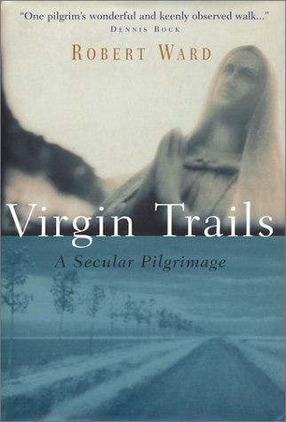
The book follows the author as he visits various European sites with connections to Mary (mother of Jesus). He gets the idea while visiting a chapel near Finisterre, a place I may visit after the Way of Saint James (haven't decided if I will walk the extra 60 miles or use some other mode of transportation).
He then travels to Paris, Lourdes, Fatima, Rome, and other places including walking the Way of Saint James (the Camino). I have to say that I was most interested in the chapter about the Camino. He has an internal debate that I have had many times while on a trail: Is it better to walk alone or with a group. Alone gives you time to think, to contemplate the scenery along the trail, and, especially true concerning a pilgrimage, to consider why you are putting yourself through this particular ordeal. Hiking with a group gives you someone to share the experience and you can often glean information that you may not know from one of your companions. Ward notes that when he walked with people he was distracted from the Camino and that the conversations tended to be about things completely unrelated to the Camino like their lives back home and their jobs. In the end he walked mostly alone, saving the social interaction for the towns, albergues, and bars.
He also separated the racers from the true pilgrims. The racers just want to get to the next stopping point. The walk is just that , a long walk. The pilgrim, even the secular ones, stop along the way to study their surroundings. They visit churches, monasteries, old roman bridges, and other interesting things along the Camino. I can often be a racer. Who knows what I've missed on the trail. I often have to remind myself to look up and notice the world around me. When I do the Camino, a want to be a pilgrim.
The subtitle of the book implies that Ward is an atheist. He says so several times in the book but not excessively though. As I read the book, I wondered just how much of an atheist he was. He seemed a little too interested in Mary to be completely secular. Maybe it was just a cultural fascination but I wonder if there was a spark of 'I want to believe' in there.
The book is interesting though, as a study of Mary sites, it seems rather limited. I suppose a comprehensive book about places dedicated to Mary would span several tomes. But even with the necessity to limit it to a hand full of places, the book was still interesting. I would recommend it.
Thursday, May 13, 2010
Hiking Iowa: Wabash Trace Nature Trail - Coin to Blanchard

The section is about 11.32 miles round trip and follows the main road between Coin and Blanchard. As I approached the end I was expecting at least a kiosk indicating that you'd reached the end. What I found was a rusty iron ranger. There wasn't even a sign marking the state border. The trail continued south but I decided to stop at the state line. I'd arrived at the end of the Wabash Trace.
I walked into town. Blanchard is a pretty small place. They do have a post office and a few commercial buildings but not much else. On the way out of town I was chased by a fierce looking dog who I suspect was more bark than bite. I was also howled at by a bloodhound - funny looking dogs them bloodhounds.
I managed to take a picture of an owl on this hike. It was far away, resting on an electric pole. I also saw an Oriole, a first for me. These pictures, and all pictures I've take on the Wabash Trace, can be found in my 2009-2013 Wabash Trace Nature Trail Hike Google Photos album.
Another first, someone actually asked me how far I'd walked. Most people just ignored me as I walked through their towns and by their farms. A man in Coin took the time to ask. I took the time to answer.
So I completed the entire Wabash Trace Nature Trail. All 62.3 ± miles (124.6 miles since I walked there and back). I managed to do it in 10 segments. I hope to do some segments on bike this summer with the Wife.
My next endeavor will be the Steamboat Trace. I'll post about that hike sometime in the next week. It will be the longest and hardest hike I've ever attempted.
Sunday, May 09, 2010
Mother's Day Cruise And Brunch
The Wife and I took my Mom and E for brunch on the River City Star, a riverboat that takes you up and down the Missouri river. The cruise was the Mother's day special which included a surprisingly, and satisfyingly, good buffet brunch. We had a fun time despite the rather chilly weather and stiff breeze that kept most of the mothers and children inside.
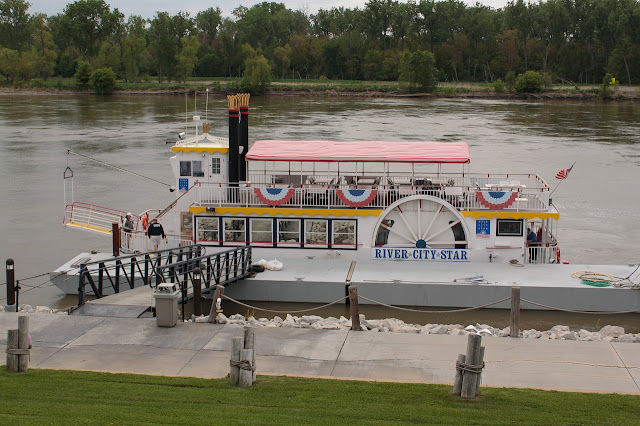

Happy Mother's Day, Mom!!!
and Happy Mother's Day to all the other Moms out there!!!
Saturday, May 08, 2010
Music: Enter The Haggis With The Spring Standards
It'd been quite a while since the Wife and I have been to a concert, our last being Gordan Lightfoot back in October of last year. Our choice of next concert was a rather obscure Canadian band that I'd heard on a podcast several years ago. I'd bought their CD "Casualties of Retail " (Direct from the band's website as they weren't at Amazon back then) and fell in like with the energetic Celtic rock sounds of Enter the Haggis. Going to this concert was a risk as going to a concert after hearing only one five year old album, one that the Wife had never heard of, could have been disappointing and, as usual, I was somewhat worried.
The show started with a warm up band that I'd never heard of before, The Spring Standards. What a pleasant surprise. Warm ups for obscure bands tend to be rather average beginners who haven't found their groove yet. This was not the case with the Spring Standards. The trio were pretty good. Each musician often played multiple instruments each song. Keyboard/percussion/vocal, trumpet/percussion/guitar, Guitar/percussion/harmonica. At times it was almost funny, like watching three one-man-bands up on the stage, but the sounds they made were great. Their thirty minute set was a good warm up for Enter The Haggis and I was motivated to buy their album "Would Things Be Different ".
".
Enter The Haggis took the stage and pretty much wowed us. My worries evaporated as soon as they started playing. They played music from their three CDs including their new one "Gutter Anthems ". The quintet consists of a bass, a drummer, a guitar/vocalist, a keyboard/guitar/fiddle/vocalist, and a flute/harmonica/vocal/bagpiper. All I have to say is that every rock band should have a bagpipe player. Seriously. Bagpipes rule and really add that little extra something to this Celtic rock band's music. The fiddler was pretty good too. By the end of the night they had people dancing in the aisles.
After the show you had a chance to meet with both bands, get autographs, and buy merchandise. It's nice to catch a band before they become unapproachable. Between the shows a guy commented to the Wife that the Spring Standards were pretty good and she agreed. Turns out the guy was the Enter The Haggis' bagpiper.
If you have a chance to see either of these bands, do it, they are worth it.
The concert was at the Scott Recital Hall in the Holland Center. The hall has an intimate, club feel. Your seats are at tables and drinks and snacks are served while you enjoy the show. It's always a plus when you don't have to stand in line for food and drink. Cameras weren't allowed so no pictures ... only good memories of good music and a needed night out.
The show started with a warm up band that I'd never heard of before, The Spring Standards. What a pleasant surprise. Warm ups for obscure bands tend to be rather average beginners who haven't found their groove yet. This was not the case with the Spring Standards. The trio were pretty good. Each musician often played multiple instruments each song. Keyboard/percussion/vocal, trumpet/percussion/guitar, Guitar/percussion/harmonica. At times it was almost funny, like watching three one-man-bands up on the stage, but the sounds they made were great. Their thirty minute set was a good warm up for Enter The Haggis and I was motivated to buy their album "Would Things Be Different
Enter The Haggis took the stage and pretty much wowed us. My worries evaporated as soon as they started playing. They played music from their three CDs including their new one "Gutter Anthems
After the show you had a chance to meet with both bands, get autographs, and buy merchandise. It's nice to catch a band before they become unapproachable. Between the shows a guy commented to the Wife that the Spring Standards were pretty good and she agreed. Turns out the guy was the Enter The Haggis' bagpiper.
If you have a chance to see either of these bands, do it, they are worth it.
The concert was at the Scott Recital Hall in the Holland Center. The hall has an intimate, club feel. Your seats are at tables and drinks and snacks are served while you enjoy the show. It's always a plus when you don't have to stand in line for food and drink. Cameras weren't allowed so no pictures ... only good memories of good music and a needed night out.
Thursday, May 06, 2010
Hiking Iowa: Wabash Trace Nature Trail - Shenandoah to Bingham

This segment was from Shenandoah to Bigham - 11.09 miles roundtrip and almost 9 miles shorter than the last segment.
The trail is the same as the other segments. Spring has once again taken firm root and everything is green and full of life. I almost stepped on a snake sunning itself on the trail. This section had a tunnel, not common on this trail.
Bingham, my turnaround point, is where I found the porch swing bench. I decided to actually walk through the "town". The loop that goes through Bingham feels like someone's front drive. There are six or seven homes including an abandoned one or two. I didn't see any businesses at all. Another town victim of the closing of the train line.
I sat and ate a snack on the porch swing before heading back. It was a relatively uneventful hike adding miles to my repertoire but not much else. I still have one more segment to go between Coin and Blanchard. After that I'll have to find hikes with more interest.
I added a few pictures to my 2009-2013 Wabash Trace Nature Trail Hike Google Photos album.
I've spent the last few days since I got back from the hike fighting ... something. Tired, body aches, fever, stomach cramps - general poopiness. I hope I get better before tomorrow night as we have a concert to go to - more on that later.
Monday, May 03, 2010
Shaving ... Check.
Disclaimer: I've been drawing blanks lately for things to post about. I've been rolling this one in the back of my head for awhile and frankly ... it falls a little flat but I've decided to post it anyway. My apologies.
For the past month or so I have felt like I've been in training, preparing for the Way of Saint James (El Camino de Santiago). I've started taking longer hikes on the Wabash. I've started hiking with a backpack to approximate the pack that's I'll be wearing on the camino. I've begun looking at the clothes and the equipment that will be in my pack. Of course I started putting my packing list together a long time ago - November 2007 to be exact.
One thing that will not be in my pack will be my electric razor. For most guys this would be no big deal. They probably learned to shave with a blade razor when they were in high school and are now quite proficient. I learned how to shave using an electric razor. My dad got me started. As I thought about the pilgrimage I realized an electric razor wouldn't do.
An electric razor fails weight-wise and the whole where's an outlet thing would be an inconvenience. I look terrible in a beard - I and splotches of light colored facial hair that, from a distance, looks like bald spots. I haven't had a full beard for years (decades?) so that might not be a problem anymore but the idea of an itchy, hot beard isn't appealing. The only option would be me learning how to shave with a blade razor.
Now, one skill I have, one that I am very proficient with, is the ability to turn the tiniest, simplest thing in the world into the most important and earth changing event of my life. That is what I did with learning how to shave with a blade. I went online and found videos about how to properly shave with a blade. I read how to do it properly. I fretted about it for months ... yes, months. Frankly these videos, while very instructive, made it look more complicated than it actually was. There are people out there who take shaving way too seriously. Multiple lathering. Shaving in multiple directions. Rinsing and repeating. My God, would I ever master this art, will my face die the death of a thousand cuts, or razor burned to a crisp?
I took the plunge and ordered a shaving kit at amazon. I decided to go a little old school with the soap and boar hair brush while swerving back into the modern world with a disposable razor.
Last week I lathered up as I'd seen on the YouTube and swiped the disposable razor down my face and thought "What was I worried about?!?"
I feel like such a fool. It just took me thirty-some years to learn such a basic skill. Not only that but the shave is closer than my electric razor and it doesn't take any longer to do the deed. Now I'll just have to buy some travel shaving soap and I'll be all set for Spain.
For the past month or so I have felt like I've been in training, preparing for the Way of Saint James (El Camino de Santiago). I've started taking longer hikes on the Wabash. I've started hiking with a backpack to approximate the pack that's I'll be wearing on the camino. I've begun looking at the clothes and the equipment that will be in my pack. Of course I started putting my packing list together a long time ago - November 2007 to be exact.
One thing that will not be in my pack will be my electric razor. For most guys this would be no big deal. They probably learned to shave with a blade razor when they were in high school and are now quite proficient. I learned how to shave using an electric razor. My dad got me started. As I thought about the pilgrimage I realized an electric razor wouldn't do.
An electric razor fails weight-wise and the whole where's an outlet thing would be an inconvenience. I look terrible in a beard - I and splotches of light colored facial hair that, from a distance, looks like bald spots. I haven't had a full beard for years (decades?) so that might not be a problem anymore but the idea of an itchy, hot beard isn't appealing. The only option would be me learning how to shave with a blade razor.
Now, one skill I have, one that I am very proficient with, is the ability to turn the tiniest, simplest thing in the world into the most important and earth changing event of my life. That is what I did with learning how to shave with a blade. I went online and found videos about how to properly shave with a blade. I read how to do it properly. I fretted about it for months ... yes, months. Frankly these videos, while very instructive, made it look more complicated than it actually was. There are people out there who take shaving way too seriously. Multiple lathering. Shaving in multiple directions. Rinsing and repeating. My God, would I ever master this art, will my face die the death of a thousand cuts, or razor burned to a crisp?
I took the plunge and ordered a shaving kit
Last week I lathered up as I'd seen on the YouTube and swiped the disposable razor down my face and thought "What was I worried about?!?"
I feel like such a fool. It just took me thirty-some years to learn such a basic skill. Not only that but the shave is closer than my electric razor and it doesn't take any longer to do the deed. Now I'll just have to buy some travel shaving soap
Subscribe to:
Posts (Atom)