UPDATED 10-18-2020
Day 37 - I left Hot Springs late because I'd forgotten to buy a gas canister for my stove. The outfitter opened at 9:00am and they were out of small cannisters so I bought a huge, heavy one.
 |
| The French Broad River along the trail. |
 |
| A bench begging to be sat on next to the serene pond. |
The full pack of food and bigger gas canister didn't help - by the time I got to the Spring Mountain Shelter I was exhausted. By the the numbers the climb up to this shelter was not as bad as the first day in the Smokies but I was more tired and worn out today. This was a bit demoralizing. I felt I was backsliding. It was supposed to be getting easier.
Day 38 - My plan for the day was to do a short hike to the next shelter some 8.6 miles (13.8 km) away. When I got there I felt like I'd gone through the wringer. I was pooped.
I stopped at the shelter and rested. Drank some water and ate some food. Then I made an odd decision. I decided to hike the 7.3 miles (11.7 km) to the next shelter.
 |
| Note the AT blazes going down the rock wall. I climbed down the wall hand over hand. |
 |
| Passed the three hundred mile mark. |
There were several people at the shelter including an Italian named Long Feather (for the feather in his hat) who played the guitar.
Day 39 - The forecast had rain Saturday and Sunday. Some people in the shelter were going to hunker down. This didn't make sense to me so I started out in the drizzle.
There was only one hill in my way, Big Butt Mountain (love how things are named in these parts). It was just a light intermittent drizzle when I crossed the crusty rocky top of big butt. After the summit it started to rain harder.
I started humming songs with the word 'sunshine' in their title. It worked. My mood was lifted up and I really made good time down the hill. The good mood was countered by an older hiker wearing a Trump 2020 hat who liked to preach to the younger generation. I did my best to politely ignore him.
At the bottom I made my way to the Laurel Hostel. This place is tiny and has few amenities but it was dry and warm and the shower was hot. The resupply was non-existent so the owner took me and a few other hikers to Erwin, TN for resupply and McDonald's take out.
Day 39 - The forecast had rain Saturday and Sunday. Some people in the shelter were going to hunker down. This didn't make sense to me so I started out in the drizzle.
 |
| Is this Big Butt Mountain's crack? |
I started humming songs with the word 'sunshine' in their title. It worked. My mood was lifted up and I really made good time down the hill. The good mood was countered by an older hiker wearing a Trump 2020 hat who liked to preach to the younger generation. I did my best to politely ignore him.
At the bottom I made my way to the Laurel Hostel. This place is tiny and has few amenities but it was dry and warm and the shower was hot. The resupply was non-existent so the owner took me and a few other hikers to Erwin, TN for resupply and McDonald's take out.
While I was heading north we heard stories of a murder on the AT. Turns out the murderer stopped at the Laurel Hostel briefly. The owner pointed out a hole made by a knife point. Apparently the guy known as Sovereign stabbed his knife into the top of the coffee can tip can. The owner then told him to leave (no doubt backed by the second amendment). Soon afterward the guy killed a hiker and almost killed another.
Day 40 - The forecast for today was more rain so a few of us decided to take a zero in the hostel. We went into town again to eat and get more supplies. This was the third weather related zero day and I wondered if I'm being too cautious. Hiking in the rain can suck but as they say "you must embrace the suck." This zero day ate up my extra day I'd earned a few days ago. In hindsight I should have not taken the zero day at the hostel. It really didn't rain that much the next day. The confederate flag under one of the bunks didn't make me comfortable either.
 |
| This appears to be a bear print on the trail but no bear has been seen yet. |
The owner of the hostel was nice enough. His older brother would show up every now and then. His accent was so thick I could hardly understand him. A hiker from Netherlands was fascinated by him since he had no clue what he was saying. He just kept nodding his head.
This day also tied for the longest hike in terms of days hiked I've ever done matching my second Camino.
Day 41 - After talking with other hikers over the past couple of days I decided to push hard the next couple of days. This day would be a long 15.9 miles (25.6 km) predominantly up hill.
It was a very long day and it was overcast and a bit uninspiring but after seeing some interesting but muted views from Big Bald Mountain I arrived at Big Bald Mountain Shelter where I spent the night with a few other hikers.
Day 42 - Temperatures were in the low 40s this morning and for some reason I was really cold. I think some of my insulating fat layers have been replaced with non-insulating muscle. I spent most of the night putting on more layers.
I left early and hiked hard in an attempt to warm up. Today I would push hard again, this time predominantly down. By the end of the day I'd hiked 16.8 miles (27 km) to Uncle Johnny's Nolichucky Hostel and Cabins just outside Erwin, TN.
I rented a cabin that had a set of bunk beds with full size mattresses. I've never seen that large of a bed. The hostel has an outfitter and offered three free shuttle trips into Erwin. I took one of those shuttles into town to resupply and eat an Italian dinner.
This day also tied for the longest hike in terms of days hiked I've ever done matching my second Camino.
 |
| A meadow is a nice change of scenery along the trail. |
It was a very long day and it was overcast and a bit uninspiring but after seeing some interesting but muted views from Big Bald Mountain I arrived at Big Bald Mountain Shelter where I spent the night with a few other hikers.
 |
| Is that Pi or is a shelter nearby? |
 |
| Lots of rain equals lots of water in the streams. |
I rented a cabin that had a set of bunk beds with full size mattresses. I've never seen that large of a bed. The hostel has an outfitter and offered three free shuttle trips into Erwin. I took one of those shuttles into town to resupply and eat an Italian dinner.
I spent time with a few hikers I knew including Eastwood and Jim (He always wore a bandana but too many hikers were named Bandana). Jim and I had spent the last few shelters and the Hostel together.
The hard hiking days I'd just done had pushed me a day ahead of schedule.
Day 43 - Another zero day to recover from the two hard days I'd just hiked. A shuttle into town for breakfast and a relaxing afternoon at the hostel to let my body recover. That was what I needed.
A lot of hikers here were shuttling ahead to Damascus to celebrate Trail Days. It's a big celebration with gear vendors, food, and lots of drinking. I decided to skip it. Who knows, I may catch up to people who took time off for the festivities. I expect the trails to be empty between Erwin and Damascus. Eastwood and Jim took the shuttle. I never saw them again.
Pictures can be found in my 2019 Appalachian Trail Google Photos album.
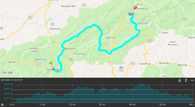
Total Distance: 355.16 Miles (571.58 km)
Section Distance: 70.35 Miles (113.22 km)
Section Elevation Up: 15,928 ft (4,855 m)
Section Elevation Down: 15,794 ft (4,814 m)
|

NOTE:. Due to human error, part of the GPS track was not recorded properly. I drew in the approximate route on the map but the elevation data listed above is an approximation.
No comments:
Post a Comment